
Map tips you didn't know you needed
August 03 2021

When planning an objective, the difference between an epic day and getting skunked can come down to the quantity and quality of time spent researching beforehand. Here are some tips to help you get the most out of the mapping and routefinding portion of you pre-trip planning.
Satellite imagery
The 800lb gorilla is obviously Google, and their Maps app is a top-notch research tool. It’s easy to assume that they have the best satellite imagery hands down, but this isn’t always the case. You can always compare alternate imagery from places like Bing Maps and MapQuest, especially if you’re not satisfied with Google’s. All satellite imagery providers have areas around the globe that they display in varying resolution and often these areas differ between companies. For a recent trip to the Alaska Range just outside of Anchorage, I was disappointed to find that Google didn’t have high resolution imagery of the area I was scouting, and their photos seemed to have been taken in winter. After a bit of poking around, I was delighted to find that MapQuest had very high-quality satellite data, and their imagery was from summertime, the same time of year we’d be there.
The 800lb gorilla is obviously Google, and their Maps app is a top-notch research tool. It’s easy to assume that they have the best satellite imagery hands down, but this isn’t always the case. You can always compare alternate imagery from places like Bing Maps and MapQuest, especially if you’re not satisfied with Google’s. All satellite imagery providers have areas around the globe that they display in varying resolution and often these areas differ between companies. For a recent trip to the Alaska Range just outside of Anchorage, I was disappointed to find that Google didn’t have high resolution imagery of the area I was scouting, and their photos seemed to have been taken in winter. After a bit of poking around, I was delighted to find that MapQuest had very high-quality satellite data, and their imagery was from summertime, the same time of year we’d be there.

MapQuest's satellite imagery (left) compared to Google's (right)
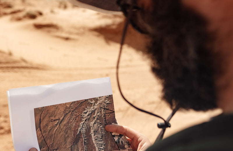
Topo maps
In my opinion there is one company that provides custom topo maps who is head and shoulders above the competition: caltopo.com. With an intuitive user interface and no shortage of features, making your own topo map is very easy and most importantly- free. You can select between multiple base layer options (including satellite imagery), and from there you can overlay all sorts of interesting data from public land boundaries to slope angles. After that it’s crop, export and voila. I can think of one exploratory slot canyon trip in Capitol Reef National Park where that slope angle tool would have saved us one hell of a sketchy approach.
In my opinion there is one company that provides custom topo maps who is head and shoulders above the competition: caltopo.com. With an intuitive user interface and no shortage of features, making your own topo map is very easy and most importantly- free. You can select between multiple base layer options (including satellite imagery), and from there you can overlay all sorts of interesting data from public land boundaries to slope angles. After that it’s crop, export and voila. I can think of one exploratory slot canyon trip in Capitol Reef National Park where that slope angle tool would have saved us one hell of a sketchy approach.

Slope angles from Caltopo
USGS Map Locator
Prefer to get your map data straight from the source? Download 7.5 minute quads for free here. The value here is that you can select what topo maps you want by the year which they were generated, which means you have access to some really old maps (sometimes well over 100 years old). This can be an extremely useful research tool depending on what your objective is because sometimes place names change and if you’re using older source documents to aid in your planning these ancient maps can be critical.
Prefer to get your map data straight from the source? Download 7.5 minute quads for free here. The value here is that you can select what topo maps you want by the year which they were generated, which means you have access to some really old maps (sometimes well over 100 years old). This can be an extremely useful research tool depending on what your objective is because sometimes place names change and if you’re using older source documents to aid in your planning these ancient maps can be critical.
Online Forums
No matter how remote your destination, there is a good chance that somewhere online someone has posted a photo or a bit of wisdom which will aid in your navigation. To uncover these gems, I start by searching for pertinent place names followed by the word “forum”. There are online forums for every hobby imaginable where core users post trip reports and discussion ensues. I’ve found myself on hunting forums, birdwatching forums, or ATV forums when planning mountaineering or canyoneering objectives only to find that the route I had been planning was unnecessarily treacherous and that there is an alternate straightforward streambed, gulley, cliff band etc. to traverse.
No matter how remote your destination, there is a good chance that somewhere online someone has posted a photo or a bit of wisdom which will aid in your navigation. To uncover these gems, I start by searching for pertinent place names followed by the word “forum”. There are online forums for every hobby imaginable where core users post trip reports and discussion ensues. I’ve found myself on hunting forums, birdwatching forums, or ATV forums when planning mountaineering or canyoneering objectives only to find that the route I had been planning was unnecessarily treacherous and that there is an alternate straightforward streambed, gulley, cliff band etc. to traverse.

A traverse that would have been nice to avoid
Micro Routefinding
This one piggybacks on the “online forums” section. Sometimes there will be obstacles, landmarks or preferred routes which just don’t show up on topo maps, but are well documented on blogs, forums, or trip reports. Maybe it’s a photo taken of a notable tree at the head of the approach gulley that will help you confirm you’re in the correct place. Maybe it’s a photo of a crack system through steep rock that will provide a reasonable exit from a canyon bottom. Maybe it’s a photo of a side stream entering a river which is your cue to start heading uphill. On a recent trip to Alaska I found a photo of a stunning ice cave on a guide company’s website, but the location was a secret. I knew the general area, and in the background of the photo were some distinctly shaped couloirs. After a couple hours of scouring Google Earth I found the couloirs in question, which led be to an approximate location of the ice cave.
This one piggybacks on the “online forums” section. Sometimes there will be obstacles, landmarks or preferred routes which just don’t show up on topo maps, but are well documented on blogs, forums, or trip reports. Maybe it’s a photo taken of a notable tree at the head of the approach gulley that will help you confirm you’re in the correct place. Maybe it’s a photo of a crack system through steep rock that will provide a reasonable exit from a canyon bottom. Maybe it’s a photo of a side stream entering a river which is your cue to start heading uphill. On a recent trip to Alaska I found a photo of a stunning ice cave on a guide company’s website, but the location was a secret. I knew the general area, and in the background of the photo were some distinctly shaped couloirs. After a couple hours of scouring Google Earth I found the couloirs in question, which led be to an approximate location of the ice cave.
Google Earth
3D satellite imagery?! Oh yeah. For routefinding and mapping purposes this is mostly a party trick, but it can help to get a feel for an area in a way that topo map slope analysis can’t. Plus, you can drop pins and create a .kml itinerary for fellow trip members.
3D satellite imagery?! Oh yeah. For routefinding and mapping purposes this is mostly a party trick, but it can help to get a feel for an area in a way that topo map slope analysis can’t. Plus, you can drop pins and create a .kml itinerary for fellow trip members.
1 comment
Thanks for this article. The pictures that accompanied it were great too. I learned a lot.